— Know Your District
Redbud in context.
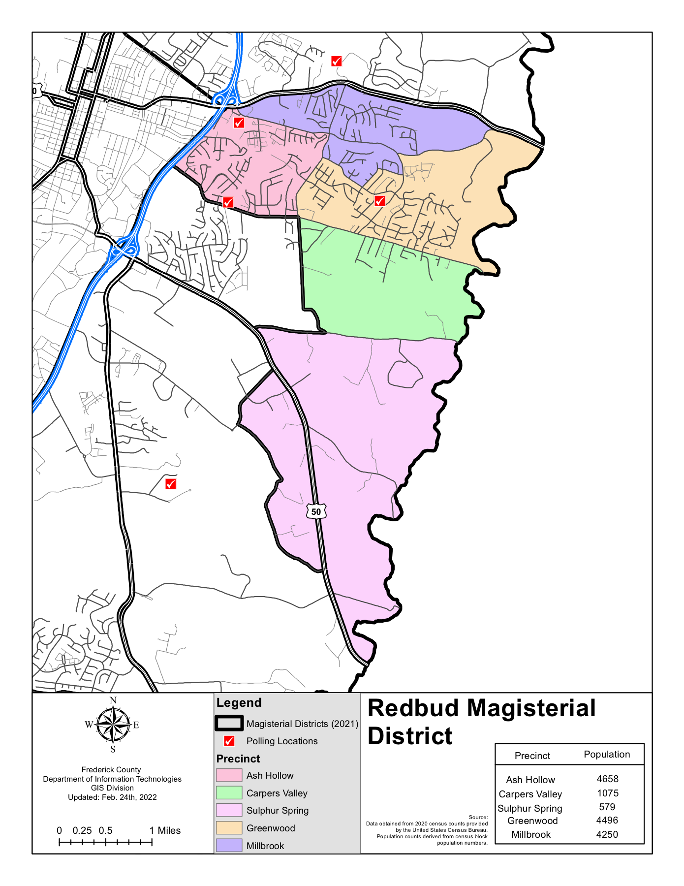
The Redbud District is one of seven magisterial districts in Frederick County. Residents most often reference the Greenwood Road and Senseny Road corridors, along with the broader east-central county footprint.
Official Redbud District Map
— Boundary Description
How the district is laid out.
Red Bud Magisterial District begins at the intersection of Senseny Road and Interstate 81 southbound, then runs along the city boundary near Route 7, east to the Clarke County line, south to Route 50, and back through Airport Road, Victory Road, Sulphur Spring Road, Greenwood Road, and Senseny Road to the starting point. The full legal-style boundary description helps residents orient the district beyond the visual map.